Hiking trip on Bornholm

Everyone can go on a hiking holiday to Bornholm, regardless of whether you're young or old, a beginner or an experienced hiking enthusiast. You can hike at your own pace and adapt your hiking holiday to what you're comfortable with and what your body can handle.

There are many great reasons why Bornholm is one of Denmark's most popular hiking destinations. The island offers several hiking trails, of which Kyststien (Coastal Trail) is one of the absolute best.

Kyststien is a signposted hiking route of a total of 121 kilometers and takes you past rocky coasts and white sandy beaches. You can split the route up to suit you, your level and your plans. 

Read more about the different stretches of Kyststien on this page and find inspiration for your next hiking holiday on Bornholm.

Find your next hiking route on Bornholm

Start din vandreferie på Bornholm ud med at gå fra Rønne til Hasle, hvor du primært vandre på skovsti blandt høje træer

Rønne - Hasle

Route length: Approx. 10 kilometers.

You are able to start your hiking holiday on Bornholm from the very first step off the ferry - you step directly onto Kyststien. If you need some extra snacks in your packpack, you can head into Kvickly which is located on your way north out of Rønne. We can also definitely recommend that you take a look around the town, which is cosy with good vibes, cafes and shops.

As soon as you step out of Rønne, you meet Blykobbe Plantage, which embraces you with its soft forest paths, tall trees and tranquility. The forest is also called Nordskoven and is a beloved recreational area for locals who run or walk on one of the five signposted routes. 

A little further on, you hike quite closely past three beautiful lakes with fairy-tale like names; Smaragdsøen, Rubinsøen and Pyritsøen (Emerald Lake, Rubin Lake, Pyrite Lake). The small lakes are a result of years of excavation of clay, which was used for tiles and refractory stone. Excavation ended in the 1980s and the waterholes have since then become lakes.

Take the time to explore Kultippen just south of Hasle. It's a unique landscape, which - with its barren and undulating surface - is reminiscent of a moon-landscape. Kultippen is a product of the 1904s when coal was dug on Bornholm. The waste products from the digging - clay, sand and gravel - were carted away and tipped over the edge. The large amount of waste accumulated and formed a new coastline, which we now know as Kultippen (The Coal Tip).

Continue the last stretch towards Hasle, where we can recommend grabbing lunch at Hasle Røgeri (smokehouse), which is one of the very first things you encounter on the way into town.

En kort men fantastisk strækning på din vandreferie på Bornholm, hvor du ender ved Jons Kapel

Hasle - Jons Kapel

Route length: Approx. 6 kilometers.

If you need cooling down after your hike from Rønne to Hasle, then make your way past Hasle's wonderful harbour bath. This is where locals and guest enjoy the ocean and the sunset in Hasle. The harbour bath is an architectural gem in itself and consists of a floating platform with several pools and a stair formation with springboards. 

After Hasle, you walk along the west coast and further north through the small coastal towns of Teglkås and Helligpeder. Notice how many of the houses here still have the characteristic tall chimneys; a relic from when many Bornholmers had their very own smoking oven. The chimneys remain, but next to none of them are being used today. 

At the start, this route is fairly straightforward and without any wild climbs, but just wait... Ahead of you lies a gem of an experience: A raw and legendary cliff that holds the small, but famous, cave, Jons Kapel (Jons Chapel). Legend has it that Jon set out to convert the local Bornholmers to Christianity and that he settled down in the cave, from where he told stories from the Bible. He had so much succes that in the end there wasn't enough room for all the interested and curious Bornholmers in the cave. Instead, he moved his sermons out into the open sky and stood by a cliff that looks like a pulpit. 

People can't really agree on how many steps there are down to Jons Kapel from Kyststien. Some say 150 steps, but why don't you try countring for youself. We promise the experience is worth the many steps. 

På strækningen mellem Jons Kapel og Sandvig møder du for alvor den rå natur på din vandreferie på Bornholm

Jons Kapel - Sandvig

Route length: Approx. 10 kilometers.

Bornholm's nature continues to show off on this part of the trail, which almost constantly goes up or down. On your way you will meet sheep grazing on the rocky outcrops, perhaps enjoying the view of the rugged coastline as much as you are. 

Here, Kyststien takes you through yet another piece of Bornholm's industrial history: Vang granitbrud (quarry), where granite was quarried for more than 100 years. Today, the area has been transformed into a magical nature and outdoor landscape with a shelter, mountain bike trails, climbing walls and not least a wonderful view of Vand Pier and the rest of the quarry from Broen over Bornholm (Bridge over Bornholm - also called DGI-Broen). On clear days you can see all the way to Hammershus and Hammeren Fyr from the bridge.

Shortly after Vand, Kyststien passes one of the best-known waterfalls, Pissebækken. Despite its fairly uncharming name (which directly translates to The Piss Stream), Pissebækken is a great experience, especially during spring when the melted ice and snow from winter results in more water in the stream and thus more water in the waterfall. 

From here on, Hammershus becomes increasingly visible in the horisont, and no matter how sore your legs are at this time, a visit to the old castle ruin is worth all the steps. It is a unique experience to move around the tall ruins, which hold so much history. 

If you need a rest, there is an excellent little area on Hammerhavn by the beautiful harbour buildings inspired by the sharpness of granite. 

With well-rested legs, you are now ready to take on Hammerknuden, before cosy and relaxed Sandvig greets you. Here you can't miss out on a stop at KALAS, which is one of our absolute favourite ice cream parlours on Bornholm.

På strækningen mellem Sandvig og Gudhjem møder du en masse fantastiske naturoplevelser

Sandvig - Allinge - Gudhjem

Route length: Approx. 18 kilometers.

The two towns, Sandvig and Allinge, have gradually grown well together. Every year, the double town forms the setting for Folkemødet (a Danish political festival), where tens of thousands gather for political and social debates on every vacant spot in the area. By the coast in Allinge, you will find a dome that was built in 2012 for Folkemødet. The dome is now a well-known landmark for Folkemødet and is used every year for different activities during the festival.

Between Allinge and Tejn, you will be walking a rather tedious and uninspiring stretch of asphalt for approx. 4 kilometers. There isn't much else to do than focusing on the beautiful view of the rugged coastline, which is the reason why Kyststien hasn't been built right by the water on this stretch.

In Tejn, the Bornholm gourmet wave has caught on, especially by the harbour, where you can find Penyllan micro brewery, ISVÆRKET ice cream parlour (which has the same owners as KALAS in Sandvig) and Smedjen, which has a cafe, street food and occasional markets. 

Nature returns after Tejn, and from here you can enjoy a lovely, fairly plat forest path that winds past Bornholms Kunstmuseum (art museum) and all the way to Gudhjem.

Along the way, there are several nature experiences that require ascents and descents, but which are without a doubt worth the hardships: the waterfall in Døndalen, the cliff cave Sorte Gryde, Helligdomsklipperne and Røverborgen. 

It's a special experience to arrive at Gudhjem on foot with the change from the quiet wooden path to the hilly old coastal town, teeming with life and charm.

Tag på vandretur og nyd strækningen mellem Gudhjem og Svaneke

Gudhjem - Svaneke

Route length: Approx. 16 kilometers.

The path from Gudhjem and on to Melsted is a spectacularly beautiful path surrounded by cliffs. After Melsted, you hike on alternately rock paths and forest paths all the way to Svaneke with a bunch of experiences along the way.

Make sure to keep an eye out for the wooden sign for Randkløve skår - a beautiful cliff riff approximately 2 meters wide and 14 meters tall. If you are in great shape and tempted by adventure, you can climb left around the riff, down to the beach and back up again through the riff. A quite demanding climb where you are climbing on rocky pieces of cliff the size of refrigerators.  

This part of Kyststien is also called the Cobra trail and is generally an incredibly beautiful and well-kept hiking gem. Here is also a secret port - Haralds Havn- which was used to sail refugees to Sweden and weapons back to Bornholm during World War 2. The Germans never discovered the port. 

In Svaneke you will find one of the most charming towns on Bornholm. Actually, Svaneke has previously been named Denmark's most beautiful market town. So don't hestitate to spend some time to explore the shops, restaurants and the winding streets of the town.

Fra Svaneke forlader du for alvor den klippeprægede del af Bornholm og bevæger dig mod Nexø og øens smukke sandstrande

Svaneke - Nexø

Route length: Approx. 10 kilometers.

Svaneke is - along with Gudhjem - one of Bornholm's biggest magnets for holidaymakers. If you hike out of season, you'll see how much life there is in the towns - even when the summer is over.

If you hike around the whole island, you need to really enjoy this part of Kyststien, as this is the last stretch with rocky coast before you meet the white, sandy beaches in the south. This stretch is varied but without big climbs. 

Right on the outskirts of Svaneke, you walk past a little beachy paradise, Hullehavn, with beach volleyball, beach bar and a jetty with a springboard. A great place for a swim!

Shortly after Svaneke and Hullehavn is Aarsdale, which - especially in recent years - has really dusted itself off and blossomed with life, restaurants, bars and other exciting initiatives. 

From here you move towards Nexø, which is Bornholm's second largest town and the trading town of the island. Here you experience raw charm and can see clear traces of the booming fishing industry that characterized Nexø and large parts of the island through the 1980s. Today, the town has reinvented itself as a creative and buzzing trading town with many exciting shops. If you're hungry from your hike, we can recommend Nexø Røgeri (smokehouse) in the outskirts of town or Paloma and Maries on the harbour.

Strækningen mellem Nexø, Boderne og Rønne byder på nogle af Bornholms allerbedste sandstrande

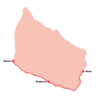
Nexø - Boderne - Rønne

Route length: Between 40 and 45 kilometers.

This stretch is very long, so we recommend you stay somewhere for a night along the way, possibly in Boderne which is approx. midway.

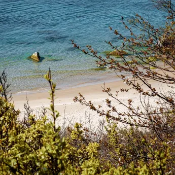
South of Nexø you will be greeted with the island's lovely sandy beaches, first in Balka, which has a gem of a beach and is a great place to take off your hiking shoes and give your feet some well-deserved air. 

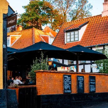
On your way through Snogebæk, you walk pass Sørens Værtshus (pub) - a favourite meeting place for both locals and tourists. In Snogebæk you will find the last grocery store before Rønne, so make sure to stock up on snacks and drinks, if you're running out.

The closer you get to Dueodde, the finer the sand becomes and is eventually just as fine as flour. It is not without reason that Dueodde beach is as famous as it is. The beach is no less than 10 kilometers long and is a popular choice for a beach day. In Dueodde is cafees, and from the lighthouse you can enjoy a beautiful view of the beach and the landscape. 

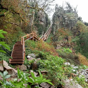
West of Dueodde, Kyststien goes a little inland along the military area, Raghammer. You hike along black and orange marked poles. Stay on the marked path while hiking here.

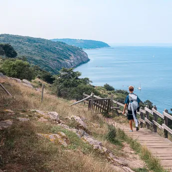
From here, a quieter hike awaits you on Bornholm's south coast. You hike both on beach and on forest trails on the top of the slope with lovely views of the sea. Pay attention to the signs on this part of Kyststien: Many hikers mistakenly think that the stretch is a tough one with sand all the way, but it most certainly is not - as long as you follow the signs that lead you along the slope path for the majority of the hike.

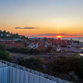
Along the way you get to Boderne; a small handful of houses and few shops dotted around for a quiet life here by the coast. You'll also find a really lovely beach here.

A little further on awaits the tiny fishing village of Arnager, which has Northern Europe's longest wooden bridge over open sea; a 200 meter long wooden bridge connects the village to a small harbour island with fishing boats. 

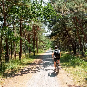
From Arnager, the coastal hike continues on the peaceful south coast. Kyststien goes around Bornholm Airport and through a beautiful, hilly summer house area further into Rønne, which is the end station of the hike.

Inspiration for your holiday on Bornholm 

Find the latest stories from Bornholm and our tips for experiences on the island in our articles.